
Santa Ana winds and wildfires in Southern California, Oct. 15–17: Norte and Henderson fires
Evacuate immediately when officials tell you to. When smoke is bad, stay in a closed-off room with a portable air cleaner and wear an N95 mask if you must go outside.
Past event. Wildfire · California · Oct. 15, 2026 to Oct. 18, 2026. In danger, call 911.
What is happening
Santa Ana winds brought National Weather Service Red Flag Warnings to Los Angeles and Ventura counties and High Wind Warnings to San Diego County, the Inland Empire and nearby mountains from Oct. 15 to 17. NWS Los Angeles/Oxnard's Red Flag Warnings ended Saturday evening, Oct. 17, and NWS San Diego's last High Wind Warnings expired at midnight. CAL FIRE reports the Norte Fire near San Juan Capistrano and San Clemente at 570 acres and 25% contained, with six homes damaged or destroyed; evacuation orders were lifted at 6 p.m. Saturday, except that Via La Mirada stays closed north of Esperanza and the burn scar stays closed. The Henderson Fire on Marine Corps Base Camp Pendleton is 3,160 acres and 50% contained.
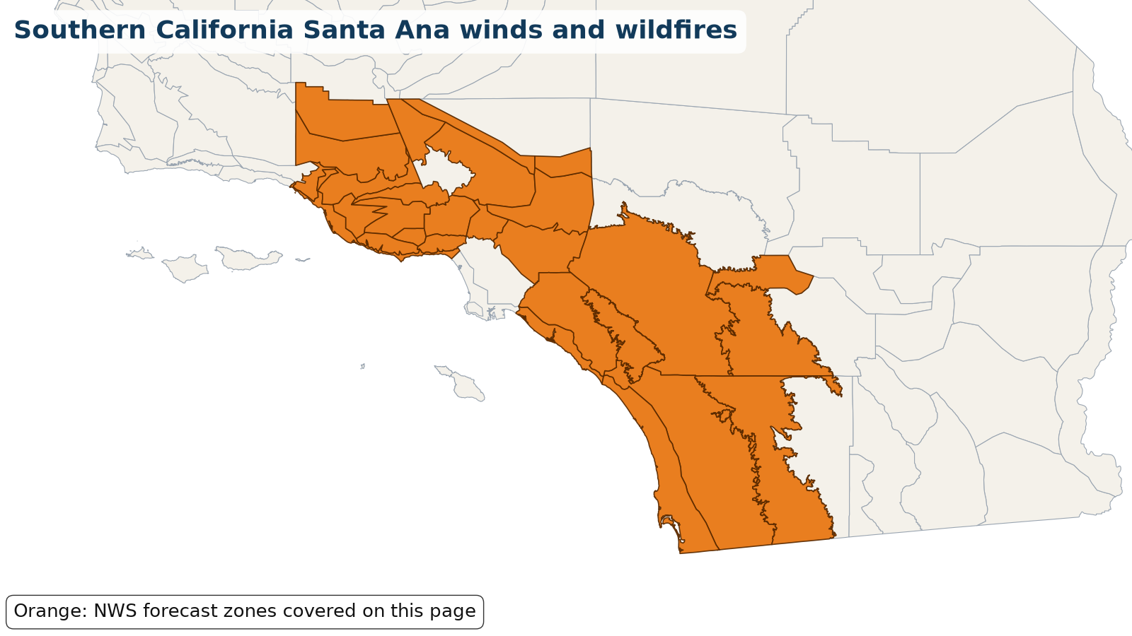
Areas under warnings include Los Angeles and Ventura county valleys, mountains and coast (Red Flag Warnings); the San Diego County valleys and mountains, the Inland Empire, the Riverside County mountains and the San Gorgonio Pass (High Wind Warnings); and coastal and inland Orange County around San Clemente, Dana Point, San Juan Capistrano and Laguna Niguel (wildfire smoke Air Quality Alert).
Source: NWS Los Angeles/Oxnard and NWS San Diego Red Flag, High Wind and Air Quality alerts, Oct. 15-17, 2026; CAL FIRE incident pages (Norte and Henderson fires). Warnings change; the live panel below is the current word from NWS.
Let family know you’re OK
Makes a message and picture you can text. Nothing is saved on our servers.
Make a check-in message
Local help near you
Open shelters and FEMA Disaster Recovery Centers in California, straight from FEMA.
Loading open shelters…
Follow for storm updates: Facebook (opens in a new tab)X (opens in a new tab)
Live NWS alerts for the affected areas
Loading live data…
FEMA disaster declarations
Loading live data…
Confirmed damage
Only official reports: NWS Local Storm Reports and damage surveys, plus statements from FEMA, USGS and state or county emergency management. No news or social media rumors.
Show storm reports and official statements
Loading NWS storm reports…
Official statements and assessments
- Official statement 2026-10-17T18:21:00-07:00
CAL FIRE's incident page for the Norte Fire (Orange County Fire Authority) near San Juan Capistrano and San Clemente reports 570 acres and 25% containment, with six homes damaged or destroyed. Its 6:21 p.m. PDT Saturday update says evacuation orders for San Clemente and San Juan Capistrano were lifted at 6 p.m., except that Via La Mirada remains closed to vehicle traffic north of Esperanza for emergency crews and the burn scar remains an active fire hazard area closed until further notice. California secured a FEMA Fire Management Assistance Grant for the fire.
Source: CAL FIRE incident page (Norte Fire), checked 2026-10-18T03:40:00-04:00 - Official statement 2026-10-17T17:56:00-07:00
CAL FIRE's incident page for the Henderson Fire on Marine Corps Base Camp Pendleton (Camp Pendleton Fire Department) reports 3,160 acres and 50% containment as of its 5:56 p.m. PDT Saturday update, with one structure destroyed. Interstate 5 was closed in both directions on Oct. 15 and 16 and has reopened; the base evacuation order for the 41 Area was lifted on Oct. 15.
Source: CAL FIRE incident page (Henderson Fire), checked 2026-10-18T03:40:00-04:00
Preliminary reports; official totals may change.
Official state and local links
- Norte Fire evacuation zones and shelters (OC Sheriff)Evacuation map, care and reception centers, animal shelters
- Norte Fire (CAL FIRE incident page)Acres, containment and evacuation orders
- Henderson Fire (CAL FIRE incident page)Camp Pendleton fire updates
- CAL FIRE current incidentsAll active California wildfires
- California Governor's Office of Emergency ServicesState emergency management
- ReadyOCOrange County emergency alerts and information
- AlertSanDiegoSan Diego County emergency information
- Ready LA CountyLos Angeles County emergency information
- Ventura County Emergency InformationVentura County emergency updates
- South Coast AQMD air quality alertsSmoke advisories and current air quality
- Caltrans QuickMapCalifornia road closures
- SCE outage centerSouthern California Edison outages and safety shutoffs
- SDG&E outage mapSan Diego Gas & Electric outages
- NWS Los Angeles/OxnardForecasts and warnings · NWS
- NWS San DiegoForecasts and warnings · NWS
During: stay safe
- Evacuate right away if authorities tell you to, and keep your phone charged.
- Check air quality at AirNow.gov or the Fire and Smoke Map.
- Choose a room you can close off from outside air and run a portable air cleaner in it. Set central air to recirculate and use high-efficiency filters.
- Use an N95 mask to limit smoke inhalation if you have to be outside.
- If you're trapped, call 911, give your location, and turn on lights to help rescuers find you.
Source: (Ready.gov: Wildfires)
After: recover
- Don't go home until officials say it's safe.
- Avoid hot ash, charred trees and smoldering debris; the ground can hold heat pockets.
- Wear long sleeves, long pants, gloves, sturdy shoes and a respirator for cleanup, and wet debris to keep dust down.
- Photograph all damage and make an inventory before contacting your insurer.
More official guidance
- AirNow air qualityYour local AQI · EPA/AirNow
- Fire and Smoke MapFires and smoke near you · AirNow
- InciWebOfficial wildfire incident updates · U.S. Forest Service
- Ready.gov: WildfiresPrepare, evacuate, return home · Ready.gov
- EPA Smoke-Ready ToolboxProtecting your health from smoke · EPA
- Wildfire and smoke: full safety guide
Get help
- Find shelterOpen shelters and hotel help
- Mental health & familySomeone to talk to, finding family
- FEMA & money helpAid, loans and free legal help
- Volunteer & donateHelp out the right way
- Safety firstGas, power lines, CO, floodwater
- After the storm: housing, mental health, money
- Insurance photo checklist
Common questions
Where can I see current warnings for the southern california santa ana winds and wildfires?
The live panel on this page pulls active alerts straight from the National Weather Service for the affected zones in California. You can also check your local NWS office or weather.gov.
Is FEMA assistance available for the southern california santa ana winds and wildfires?
Only if a federal disaster is declared for your county. The FEMA panel on this page shows any declarations as they come in; you can also check DisasterAssistance.gov or call 1-800-621-3362.
What mask protects against wildfire smoke?
Ready.gov recommends an N95 mask to protect yourself from smoke inhalation. Cloth and surgical masks don't filter the fine particles in smoke well.
How do I keep smoke out of my home?
Ready.gov says to close off a room from outside air, run a portable air cleaner in it, use high-efficiency filters in central air, and set the system to recirculate.